Monday, January 30, 2017

Derechos Destruction

Derechos are a weather phenomenon that can leave destruction similar to tornadoes.  When severe weather is a factor meteorologists monitoring radar need to watch out for these radar patterns. Meteorologists refer to bow echoes on radar during severe weather, which can signify potential rotation, but we also monitor potential radar signatures for derechos.
Image Credit:  National Weather Service

It’s not unusual for one house to be nearly destroyed while adjacent houses have relatively minor damage after storms that produced these derechos.  If you’ve ever heard the term “straight line winds” that refers to the weather phenomenon known as a derecho.

Meteorologists look for widespread, long-lived windstorms associated with a band of rapidly moving showers or thunderstorms on any given severe weather day or a day of enhanced instability.  The tern “Derecho” was coined by Dr. Gustavus Hinrichs in 1888.  The word "derechos" is a Spanish word which means "direct" or "straight ahead".  That’s why it’s commonly referred to as straight line wind damage.

The majority of derechos occur during the warm season which is May, June, July and August.  Since our planet just measured its third straight record warm year in 2016, we need to monitor every storm during the year for these radar signatures.
According to the Storm Prediction Center, derechos can cause more fatalities than EF-0 and EF-1 tornadoes combined.  The SPC says that this is in spite of the fact that EF-0 and EF-1 tornadoes comprise over 80% of all recorded tornadoes.


Sunday, July 7, 2013

Could become Tropical Storm Chantal

Models expect some organization in the next few days could become Tropical Storm Chantal.  The almost-Depression is centered near 9N 42W, or about 1400 miles east of the Windward Islands. 

Tuesday, May 14, 2013

Low tornado count across the United States so far in 2013

The total number of tornadoes through early May is considerably behind the national annual average. It is also the lowest in nearly 60 years, since at least 1954. There have been 3 tornado fatalities in 2013; by the end of May 2011, 543 Americans had died. There has been a total of 20 confirmed tornadoes in the state of Alabama from January through April 2013. We are near normal for number of tornadoes. The tornado outbreaks of April 2011 are what stand out in most people's minds, but they were not the norm.


Monday, May 13, 2013

The Deep South Chill

Alabamians are used to the wacky weather in the summer, but a late spring chill is something to talk about. Reaching for the jacket heading out to Mother's day dinner is a bit unusual and we did break some records. Here's what happened…


A large, cold core upper low covered the Deep South in early May this year. The upper level low pressure system was responsible for the wet and unusually cold weather pattern across our area from May 4th through May 6th.

It all began with a surface front that pushed eastward across the State on Friday May 3rd. Check out some of these records recorded by the NWS!

Minimum High Temperature Records

Date       Location     High Temp Previous Record/Date

May 4th Birmingham 60, 60 (1967,1921)

May 5th Birmingham 59, 60 (1917)

       *Tuscaloosa      58, 68 (1960, 1957)

May 6th Birmingham 61, 61 (1992)

Montgomery            65, 65 (1992)

Anniston                  58, 62 (1992)


NWS: *Tuscaloosa also set a new all-time record minimum high temperature for the month of May with its high temperature reading of 58 degrees on May 5th. This broke the previous record of 61 set on 5/13/1971, 5/3/1970, 5/12/1960, and 5/6/1958.
Releases at Logan Martin Dam


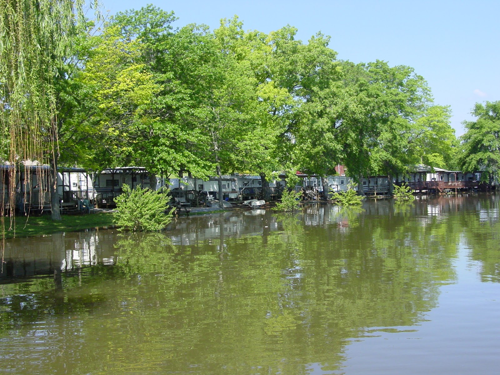
Flooding at Logan Martin Lake


Image Credit: NWS
Info By NWS, CPC

Tuesday, April 30, 2013

According to a recent list released by Dr. Greg Forbes of The Weather Channel, three Alabama cities rank in the top 10 most tornado-prone cities in the nation.  Not hard to believe coming off of one of the most active tornado seasons in history, the record breaking, deadly and costly 2011 tornado season.  Dr. Forbes gathered data from the Storm Prediction Center between 1962-2011. He uses numbers within 75 miles of the city tornado paths, including the tornado damage path widths and lengths. His method works more with probability of a particular location getting hit by a tornado than using the raw numbers of tornado that have occurred within a metro area.
1.) Huntsville
2). Jackson, Miss.
3). Birmingham
4). Tuscaloosa
5). Little Rock, Ark.
6). Tulsa, Okla.
7). Oklahoma City
8). Atlanta, Ga.
9) Wichita, Kan.
10). Nashville, Tenn.


Image by:  Harmony Mendoza

Monday, April 29, 2013

What is a rain garden?

What is a rain garden?


According to http://www.raingardennetwork.com/, a rain garden is a shallow depression that is planted with deep-rooted native plants and grasses. They recommend that the garden be positioned near a runoff source like a downspout, driveway or sump pump. This will capture rainwater runoff and stop the water from reaching the sewer system.

By building a rain garden using native plants, some property owners can reduce the amount of pollution that would enter nearby water bodies or sewer. Rain gardens can also prevent surface erosion, it can reduce standing water, and create habitat for wildlife such as bugs and birds. They work well in urban and residential areas, so no matter where you live an eden is possible.

To read more on how you can create your own, just click the link in the body of this story...happy planting!

Saturday, July 14, 2012

Thunderstorms are very common here in central Alabama

Central, Ala. - Thunderstorms are very common here in central Alabama as we all know too well. During the Summer months, when central Alabama is typically under the influence of high pressure, thunderstorms usually form along outflow boundaries or simply during the heating of the afternoon.


Click the link below for the full story:

Sunday, September 11, 2011

Harmony Mendoza's full forecast 9-11-11

Tropical Weather Outlook

NHC issuing advisories on TS MARIA and TS NATE


What Are The Hurricane Hazards?


Storm Surge - Water that is pushed toward the shore by the force of the winds swirling around the storm. This advancing surge combines with the normal tides to create the hurricane storm tide, which can increase the mean water level 15 feet or more.

Inland Flooding - In the last 30 years, inland flooding has been responsible for more than half the deaths associated with tropical cyclones in the US.

High Winds - Hurricane force winds can destroy poorly constructed buildings and mobile homes. Debris such as signs, roofing material, and small items left outside become flying missiles in hurricanes.

Tornados - Hurricanes can produce tornadoes that add to the storm's destructive power. Tornados are most likely to occur in the right-front quadrant of the hurricane.


What Should I Do With a Watch or Warning?

When a HURRICANE WATCH is issued for your part of the coast this indicates the possibility that you could experience hurricane conditions within 36 hours. This watch should trigger your family's disaster plan, and proactive measures should be initiated especially those actions that require extra time such as securing a boat, leaving a barrier island, etc. When a HURRICANE WARNING is issued for your part of the coast this indicates that sustained winds of at least 74 mph are expected within 24 hours. Once this warning has been issued, your family should be in the process of completing proactive actions and deciding the safest location to be during the storm.

Source:  http://www.nhc.noaa.gov/


Friday, July 29, 2011

Not too much longer...we'll see our first hurricane of 2011


So...Don is basically falling apart as it moves inland over south Texas. The dryness of the region and hostile upper level conditions are all contributing to its quick demise.

Thursday, January 13, 2011

At least the sunshine has returned

Highs Today - Click for more information.
Source:  NOAA/NWS
Highs today will be in the low 30s.  Some areas may not even hit the freezing mark of 32 degrees, where a decent snow pack is still present.  There is still a very cold arctic air mass in place and it continues to filter into the southeast. There will be a few high clouds today, otherwise skies will be mostly sunny.  It may be cold but, at least the sunshine has returned.

Sunday, December 12, 2010

Wind Chill Advisory

Wind Chill Advisory: remains in effect from midnight tonight to 8 am Monday.
The combination of gusty winds and cold temperatures will create extremely cold wind chill readings overnight. Wind chill values...will drop to near zero around sunrise on Monday morning. If you must venture outdoors...make sure you wear a hat and gloves.


Source: NOAA/NWS
Image Credit:  NOAA/NWS
Wind chill takes into account how wind and cold feel on exposed skin rather than solely the actual temperature. As the wind increases, heat is carried away from the body at an accelerated rate, driving down the body temperature. Animals are also affected by wind chill.

http://www.noaa.gov/

Saturday, December 11, 2010

A strong cold front will push across the Deep South tonight, bringing a line of showers and isolated thunderstorms. Temperatures will drop rapidly behind this front. We are scheduled to be at the freezing mark by early Sunday morning. The moisture source seems to be lacking so, just a mention of flurries possible at this time for the Birmingham area. The major concern after the rain will be Black Ice. Rural, valley and low lying areas in particular; Roads which appear clear in the cold season may actually be coated with a thin layer of ice, commonly called black ice. This nearly invisible ice layer can cause you to rapidly lose control of your vehicle. Black ice is most common during the nighttime hours into very early morning. If you detect black ice, reduce your speed!


Behind the front, strong gusty winds will create very cold and blustery conditions. Sustained winds will remain around 20 mph, gusts to 30 or 40 mph. This will create wind chill temperatures in the teens on Sunday...while single digit wind chills are possible in higher elevations. As colder air continues to funnel into the region...temperatures will likely fall into the teens area wide on Monday morning. Continued breezy conditions will produce wind chill temperatures below zero in some portions of the area. A wind chill advisory may be issued for Sunday night and Monday morning.

Saturday, December 4, 2010

Winter Weather Coming!


Few isolated showers expected mainly afternoon and in the evening, near Huntsville through Gadsden and Southeast. This front will bring a blast of cold air by Sunday. Tuesday morning thru Wednesday morning look to be the coldest that we have seen so far since last winter, widespread 20s and some teens.

Saturday, October 9, 2010

Wonderful Weekend Weather

The 90s Return...
When I see unseasonably cooler afternoon temperatures in the early fall, I can tell the summer temperatures are not quite finished with us yet.  I'm a meteorologist not a climatologist however, I do know the atmosphere has a way of balancing itself out.  The planet is always gearing toward equilibrium.  Bottom line...there has been cooler and hotter days...to the global warming enthusiasts.  Anyone want to chat about La NiƱa?
http://www.elnino.noaa.gov/lanina.html


Sunday, September 5, 2010

Birmingham, AL. Wonderful Weather Weekend

Records appear to be safe this morning but, we still have another cool morning on the books for your Labor Day. Low temperatures will flirt with record readings again Monday morning.


We still have a very dry air mass across Alabama. Temperatures will be in the mid 80s this afternoon. Highs will be back in the low 90s by Monday afternoon. Best chance for rain in the 7 Day Forecast rolls in by Thursday.

Saturday, September 4, 2010

Birmingham, AL. Sunny, Dry...Need I say More?

A cold front has pushed south, and finally held true to its name. This weekend expect cooler and drier air to start your mornings. I’m so excited to actually be able to hear the A/C cut-off overnight. Highs will be in the mid- upper 80s. Overnight lows tonight and Sunday night will be in the mid 50s. With some areas in the low 50s...WOW! We may be setting some record LOWS!!!


Tuesday, August 31, 2010

Birmingham Weather Forecast

Rain and drizzle this morning, temperatures holding in the low-mid 70's. Finally the grip of the summer heat has loosened. It has been nice to not be drenched in sweat from the front door of my house to the car door. Today we start off rainy, but skies will clear a bit later today and temperature will make it into upper 80's in the afternoon. We will look for partly cloudy skies with highs in the low 90's for the remainder of your workweek. A weak front will arrive Friday. There will be a chance of an afternoon or nighttime shower. Behind that front mid-upper 60s overnight.

Wednesday, August 25, 2010

Weather Forecasters Summer Dream...

  I can put my feet up today...well for now.  When I got out of the car this morning at the station, an unfamiliar cool breeze hit my ankle. That delightful breeze on Red Mountain was a marvelous gift this morning. Working outside today? Well if you are, finally a break from the heat. Today is one of those days to look ahead. We are looking toward the weekend now on the hump day. A dry cold front will push through the area by the end of the week and leave us with Party Cloudy skies and upper 80s for your highs for the weekend, mid-upper 60s overnight...Enjoy!

Monday, August 23, 2010

Tropical Storm Danielle

At this time Monday Morning, there are no coastal watches or warnings in effect.
This morning at 5:00 am EST, the center of Tropical Storm Danielle was
located near latitude 14.8 north...longitude 37.1 west. Danielle is
moving toward the west-northwest near 14 mph and this
general motion is expected to continue through Tuesday.
Maximum sustained winds are near 60 mph with higher
gusts. Additional strengthening is forecast. Danielle is
likely to become a Hurricane within the next 24 hours.
Tropical storm force winds extend outward up to 85 miles.

Source:  http://www.nhc.noaa.gov/